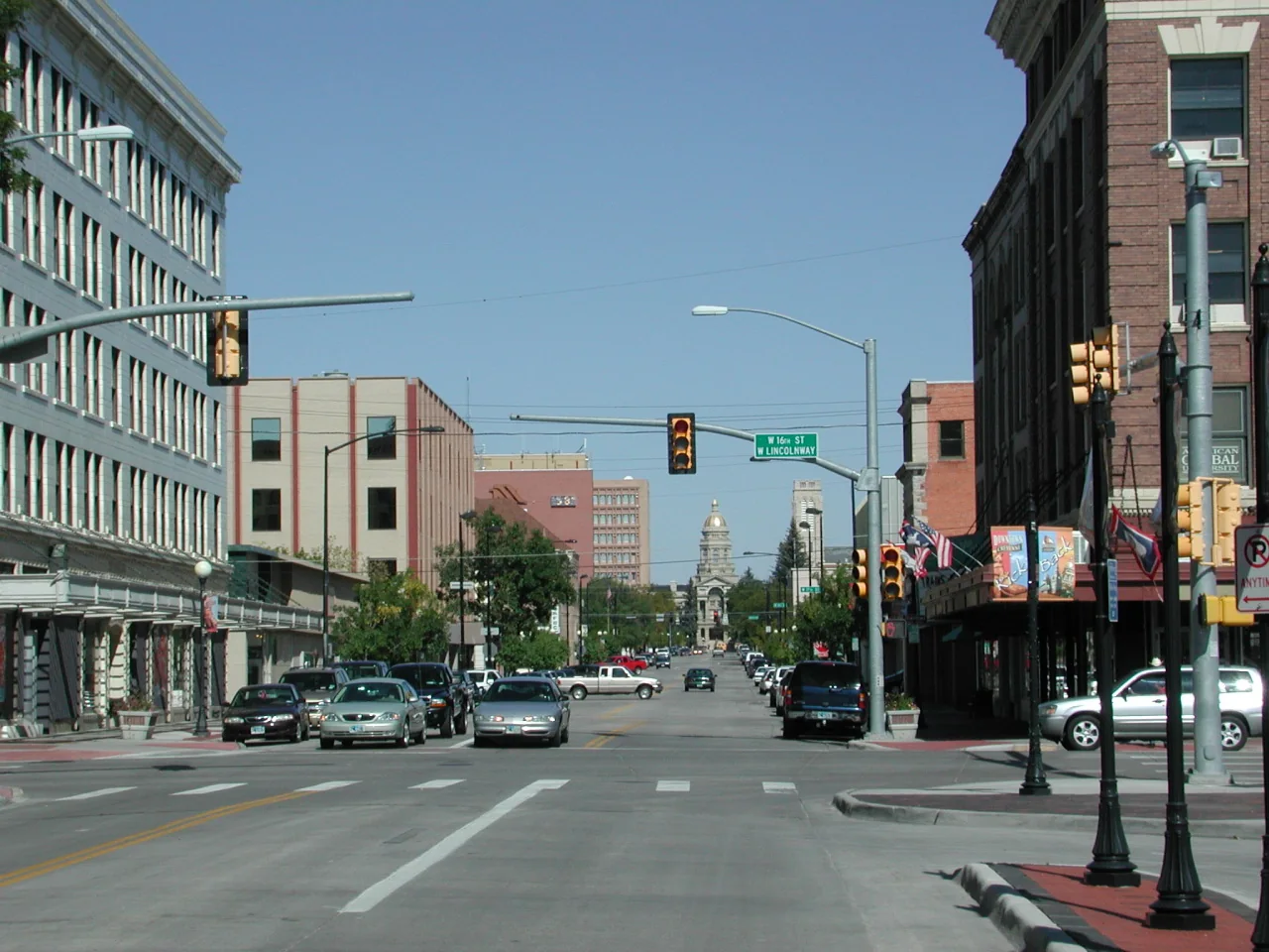
Cheyenne WY downtown

Get out of town

Day trips from Fort Collins

17 nearby parks, towns and places to explore, ordered by straight-line distance.

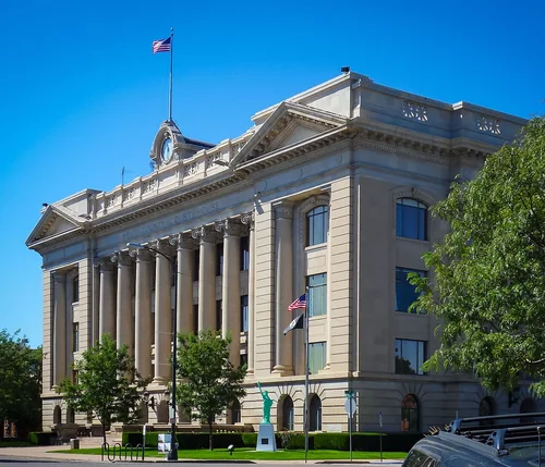
Greeley, Colorado CourthouseTown

Greeley

21 miles southeast · straight-line distanceAbout 35 min by car (30 road miles, typical traffic, checked October 2026)

City in and county seat of Weld County, Colorado, United States.

Confirm the visitor entrance, hours, reservations, access and seasonal conditions. Islands or water destinations may require different transport.
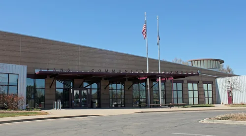
Evans, ColoradoTown

Evans

22 miles southeast · straight-line distanceAbout 35 min by car (30 road miles, typical traffic, checked October 2026)

Home rule municipality in Weld County, Colorado.

Confirm the visitor entrance, hours, reservations, access and seasonal conditions. Islands or water destinations may require different transport.
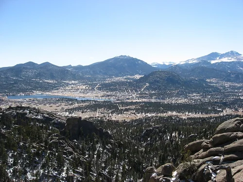
Estes Park from Gem LakeTown

Estes Park

27 miles southwest · straight-line distanceAbout 1 hr by car (40 road miles, typical traffic, checked October 2026)

Town in Larimer County, Colorado, United States.

BikingBoatingFishingHikingPicnickingWater sports

Confirm the visitor entrance, hours, reservations, access and seasonal conditions. Islands or water destinations may require different transport.
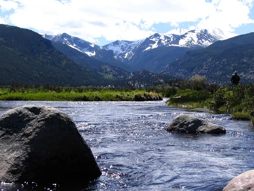
Rocky Mountain National ParkNational park site

Rocky Mountain National Park

35 miles southwest · straight-line distance

National park in Colorado, United States.

BikingCampingClimbingFishingHikingHistoryAgency site ↗

Confirm the visitor entrance, hours, reservations, access and seasonal conditions. Islands or water destinations may require different transport.
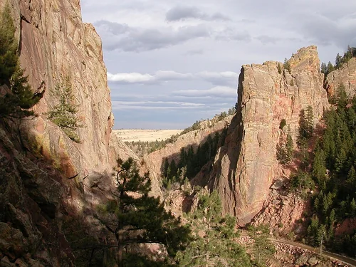
Town

Boulder

38 miles south · straight-line distanceAbout 1 hr by car (53 road miles, typical traffic, checked October 2026)

City in and county seat of Boulder County, Colorado, United States.

Confirm the visitor entrance, hours, reservations, access and seasonal conditions. Islands or water destinations may require different transport.
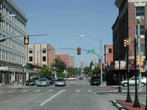
Cheyenne WY downtownTown

Cheyenne

44 miles north · straight-line distanceAbout 45 min by car (49 road miles, typical traffic, checked October 2026)

Capital city of the U.S. state of Wyoming and seat of Laramie County.

Confirm the visitor entrance, hours, reservations, access and seasonal conditions. Islands or water destinations may require different transport.
Eldorado Canyon State ParkState park

Eldorado Canyon State Park

44 miles south · straight-line distance

State park in Colorado, United States.

Confirm the visitor entrance, hours, reservations, access and seasonal conditions. Islands or water destinations may require different transport.
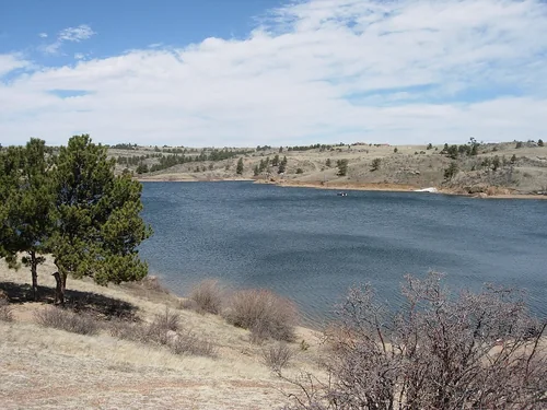
Curt Gowdy State ParkState park

Curt Gowdy State Park

44 miles north · straight-line distance

State park in Wyoming, United States.

Confirm the visitor entrance, hours, reservations, access and seasonal conditions. Islands or water destinations may require different transport.
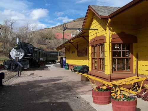
Colorado Railroad MuseumThings to do

Colorado Railroad Museum

54 miles south · straight-line distanceAbout 1 hr 5 min by car (67 road miles, typical traffic, checked October 2026)

Railroad museum in Golden, Colorado.

Confirm the visitor entrance, hours, reservations, access and seasonal conditions. Islands or water destinations may require different transport.
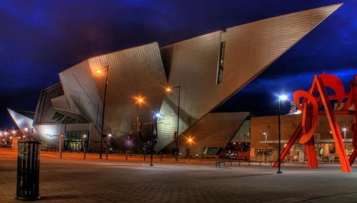
Denver art museum night archipreneur adam crainThings to do

Denver Art Museum

56 miles south · straight-line distanceAbout 1 hr by car (60 road miles, typical traffic, checked October 2026)

Museum in Denver, Colorado, United States.

Confirm the visitor entrance, hours, reservations, access and seasonal conditions. Islands or water destinations may require different transport.
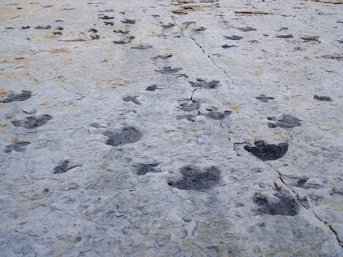
Dinosaur RidgeThings to do

Dinosaur Ridge

60 miles south · straight-line distanceAbout 1 hr 5 min by car (72 road miles, typical traffic, checked October 2026)

Ridge in Colorado, United States.

Confirm the visitor entrance, hours, reservations, access and seasonal conditions. Islands or water destinations may require different transport.
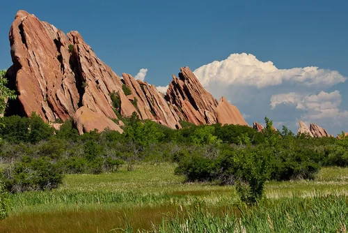
Fountain Valley Trail, Roxborough State ParkState park

Roxborough State Park

77 miles south · straight-line distance

State park in Colorado, United States.

Confirm the visitor entrance, hours, reservations, access and seasonal conditions. Islands or water destinations may require different transport.
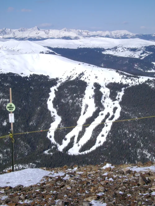
Copper Mountain, Spaulding Bowl and trailsSki area

Copper Mountain

92 miles southwest · straight-line distanceAbout 2 hr 10 min by car (135 road miles, typical traffic, checked October 2026)

Ski resort in Colorado, USA.

Confirm the visitor entrance, hours, reservations, access and seasonal conditions. Islands or water destinations may require different transport.

Ski area

Beaver Creek Resort

100 miles southwest · straight-line distanceAbout 2 hr 35 min by car (162 road miles, typical traffic, checked October 2026)

Ski resort in Colorado, USA.

Confirm the visitor entrance, hours, reservations, access and seasonal conditions. Islands or water destinations may require different transport.

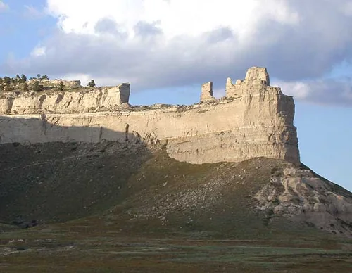
Saddlerock Scotts-Bluff NM Nebraska USA, Scotts Bluff National MonumentNational park site

Scotts Bluff National Monument

114 miles northeast · straight-line distance

National monument in the United States.

Confirm the visitor entrance, hours, reservations, access and seasonal conditions. Islands or water destinations may require different transport.

National park site

Florissant Fossil Beds National Monument

114 miles south · straight-line distance

National monument in the United States.

Confirm the visitor entrance, hours, reservations, access and seasonal conditions. Islands or water destinations may require different transport.

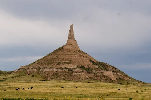
Chimney Rock National Historic SiteNational park site

Chimney Rock National Historic Site

120 miles northeast · straight-line distance

Historic site in Nebraska, United States.

Confirm the visitor entrance, hours, reservations, access and seasonal conditions. Islands or water destinations may require different transport.

Driving times are typical estimates from the city center without live traffic, Powered by Geoapify · © OpenStreetMap contributors.

Distances are measured in a straight line from the city, not by road. Some older drive-time estimates have no reliable date and do not reflect current traffic; routes to large parks or waterfronts may vary. Check the destination entrance before leaving. Place descriptions come from Wikidata. Photo credits include capture dates when available; photos may not show current conditions.

Outdoor places near Fort Collins

40 recreation areas and campgrounds within 76 miles, from Recreation.gov. Filter by what you want to do.

Recreation area

Arapaho & Roosevelt National Forests Pawnee NG

1 miles northwest · straight-line distanceUSDA Forest Service

.

BikingBoatingCampingClimbingFire Lookouts/Cabins OvernightFishingHikingHorse Camping

Recreation area

Horsetooth Reservoir

6 miles west · straight-line distanceBureau of Reclamation

Horsetooth Reservoir, Colorado-Big Thompson Project , furnishes the main water supply for the Poudre Valley. The reservoir is 6.5 miles long, and is formed by four large earthfill dams.

BikingBoatingCampingFishingHikingNature educationPicnickingRanger programs

Recreation area

Flatiron Reservoir

15 miles southwest · straight-line distanceBureau of Reclamation

Flatiron Dam and Reservoir are located on Chimney Hollow Creek 8 miles southwest of Loveland, Colorado. The dam and reservoir are features of the Colorado - Big Thompson Project . One campground with 41 campsites. Access is good.

BikingCampingFishingHikingHuntingNature educationPicnickingRanger programs

Recreation area

Carter Reservoir (Carter Lake)

16 miles southwest · straight-line distanceBureau of Reclamation

Developments include 5 campgrounds with 151 campsites and 3 boat-launch ramps. A concession-operated public marina located at the north end of the lake (970.667.1062).

BikingBoatingCampingFishingHikingNature educationPicnickingRanger programs

Recreation area

Pinewood Lake

17 miles southwest · straight-line distanceBureau of Reclamation

Pinewood Lake is located about 12 miles southwest of Loveland, Colorado. The Lake and Dam are a small part of the Colorado-Big Thompson Project , one of the largest and most complex ever constructed by Reclamation.

BoatingCampingFishingPicnickingWildlife viewing

Campground

Ansel Watrous

18 miles northwest · straight-line distanceAbout 40 min by car (26 road miles, checked October 2026)USDA Forest Service

Ansel Watrous Campground is located on the Cache la Poudre River, 22 miles northwest of Fort Collins, Colo., along Highway 14. Visitors enjoy the area for its great rafting, fishing and hiking opportunities.

BikingBirdingBoatingCampingCanoeingFishingHikingKayaking

Campground

Stove Prairie

20 miles northwest · straight-line distanceAbout 45 min by car (30 road miles, checked October 2026)USDA Forest Service

Stove Prairie Campground is located on the Cache la Poudre River, 26 miles northwest of Fort Collins, in north central Colorado. Visitors enjoy the area for its great rafting, fishing and hiking opportunities.

BikingBirdingBoatingCampingCanoeingFishingHikingKayaking

Campground

Narrows (Co)

22 miles northwest · straight-line distanceAbout 50 min by car (34 road miles, checked October 2026)USDA Forest Service

Narrows Campground is located on the Cache la Poudre River, 32 miles northwest of Fort Collins, Colorado, along Highway 14. Visitors enjoy the area for its great rafting, fishing and hiking opportunities.

BikingBirdingBoatingCampingCanoeingFishingHikingKayaking

Campground

Mountain Park

23 miles northwest · straight-line distanceAbout 55 min by car (37 road miles, checked October 2026)USDA Forest Service

Mountain Park Campground is located on the Cache la Poudre River, 40 miles northwest of Fort Collins, Colo., along Highway 14. Visitors enjoy the area for its great rafting, fishing and hiking opportunities.

BikingBirdingBoatingCampingFishingHikingRaftingWater sports

Campground

Kelly Flats Campground

24 miles northwest · straight-line distanceAbout 1 hr by car (39 road miles, checked October 2026)USDA Forest Service

Kelly Flats is a first-come, first-served campground located adjacent to Colorado Highway 14 and the Cache La Poudre River. There are 29 sites available including four walk-in tent sites.

CampingRecreational Vehicles

Campground

Jacks Gulch

25 miles west · straight-line distanceAbout 1 hr 30 min by car (46 road miles, checked October 2026)USDA Forest Service

Jacks Gulch Recreation Area is located 48 miles northwest of Fort Collins, in northern Colorado. Visitors enjoy the area for its great hiking, biking and horseback riding opportunities.

BikingBirdingCampingClimbingFishingHikingHorseback ridingMountain Biking

Recreation area

Lake Estes

26 miles southwest · straight-line distanceBureau of Reclamation

Lake Estes, a feature of the Colorado-Big Thompson Project , is formed by Olympus Dam constructed across the Big Thompson River.

BikingBoatingFishingHikingPicnickingWater sportsWildlife viewing

Recreation area

Marys Lake

28 miles southwest · straight-line distanceBureau of Reclamation

Marys Lake is part of the Colorado-Big Thompson Project. There are 2 dikes on the shoreline of Marys Lake, located approximately 2 miles from Estes Park, Colorado.

CampingFishingPicnickingRecreational VehiclesWater sportsWildlife viewing

Campground

Rocky Mountain National Park Aspenglen Campground

29 miles west · straight-line distanceAbout 1 hr 10 min by car (45 road miles, checked October 2026)National Park Service

Aspenglen is located on the east side of Rocky Mountain National Park near Fall River Entrance. All campsites in Aspenglen Campground are available by reservation only and can be reserved via Recreation.gov.

Accessible SwimmingAmphitheaterBackpackingBikingCampingCanoeingEvening ProgramsFishing

Campground

Dowdy Lake

31 miles northwest · straight-line distanceAbout 1 hr 5 min by car (48 road miles, checked October 2026)USDA Forest Service

Dowdy Lake Campground is located 48 miles northwest of Fort Collins, Colo., near the village of Red Feather Lakes. Visitors enjoy the area for its canoeing, fishing and trail opportunities.

BikingBirdingBoatingCampingCanoeingFishingHikingKayaking

Recreation area

East Portal Reservoir

31 miles southwest · straight-line distanceBureau of Reclamation

East Portal Reservoir is a feature of the Colorado - Big Thompson Project. This charming campground sits at the base of a mountain in the midst of a pine forest.

CampingFishingHikingPicnickingRecreational VehiclesWildlife viewing

Campground

Redfeather Ranger Station

31 miles northwest · straight-line distanceAbout 1 hr 5 min by car (47 road miles, checked October 2026)USDA Forest Service

The Redfeather Ranger Station has two cabins, and an office with a visitor's center. The Ranger Cabin and the Assistant Ranger Cabin are available for lodging. Guests must provide linens, bedding, pillows, towels and toiletries.

BackpackingBikingBirdingBoatingCampingCanoeingClimbingFishing

Campground

Rocky Mountain National Park Moraine Park Campground

31 miles southwest · straight-line distanceAbout 1 hr 15 min by car (46 road miles, checked October 2026)National Park Service

Moraine Park Campground is located on the east side of Rocky Mountain National Park, overlooking Moraine Park. To access the campground, enter RMNP via Beaver Meadows, Fall River or Grand Lake Entrances and follow signs to Bear Lake Road.

AmphitheaterBackpackingBikingCampingEvening ProgramsFishingGuided Interpretive WalksHiking

Campground

West Lake

31 miles northwest · straight-line distanceAbout 1 hr 5 min by car (47 road miles, checked October 2026)USDA Forest Service

West Lake Campground is located 48 miles northwest of Fort Collins, in north central Colorado, near the village of Red Feather Lakes. Visitors enjoy the area for its canoeing, fishing and trail opportunities.

BikingBoatingCampingCanoeingFishingHikingWildlife viewing

Campground

Bellaire Lake Campground

32 miles northwest · straight-line distanceAbout 1 hr 15 min by car (51 road miles, checked October 2026)USDA Forest Service

Bellaire Campground is located 47 miles northwest of Fort Collins, Colo., near the Red Feather Lakes village. Visitors enjoy the area for its canoeing, fishing and trail opportunities.

BikingCampingCanoeingFishingHikingNon-Motorized BoatingWildlife viewing

Campground

Meeker Park Overflow Campground

32 miles southwest · straight-line distanceAbout 1 hr 15 min by car (50 road miles, checked October 2026)USDA Forest Service

There are 29 first-come, first-served campsites that allow tents, campers, trailers, and RVs. Sites are best for tent camping due to unpaved roads, steep hills and short pull-ins.

Camping

Campground

Rocky Mountain National Park Glacier Basin Campground

32 miles southwest · straight-line distanceAbout 1 hr 20 min by car (49 road miles, checked October 2026)National Park Service

All campsites at Glacier Basin Campground are available by reservation only through Recreation.gov. To make a reservation, visit www.recreation.gov, use the Recreation.gov Mobile App, or call 1-877-444-6777.

AmphitheaterBackpackingBikingCampingCanoeingEvening ProgramsFishingGuided Interpretive Walks

Campground

Olive Ridge

34 miles southwest · straight-line distanceAbout 1 hr 20 min by car (53 road miles, checked October 2026)USDA Forest Service

The Olive Ridge Campground is located within the Roosevelt National Forest, situated near the southeastern corner of Rocky Mountain National Park at an elevation of 8,350 feet.

CampingHiking

Recreation area

Rocky Mountain National Park

36 miles west · straight-line distanceNational Park Service

Located in northern Colorado, visitors to Rocky Mountain National Park can explore over 415 square miles (265,807 acres) within the Southern Rocky Mountains.

BikingCampingClimbingFishingHikingHistoryHorseback ridingPicnicking

Campground

Camp Dick

37 miles southwest · straight-line distanceAbout 1 hr 15 min by car (55 road miles, checked October 2026)USDA Forest Service

Camp Dick is the site of a Civilian Conservation Corps camp that was established in the 1930s. It is located just off the Peak to Peak Scenic Byway, on the Middle Saint Vrain Creek.

BikingCampingFishingHikingHorseback ridingMountain BikingOff Highway Vehicle Trails

Recreation area

Shadow Mountain Lake

48 miles southwest · straight-line distanceBureau of Reclamation

Shadow Mountain Dam and Reservoir, Colorado-Big Thompson Project , are on the Colorado River below its confluence with the Grand Lake outlet. Developments include 1 campground with 80 campsites and 2 boat-launch ramps. Good access exists.

BoatingCampingFishingHikingPicnickingRecreational VehiclesWater sports

Recreation area

Two Ponds National Wildlife Refuge

49 miles south · straight-line distanceFish and Wildlife Service

Two Ponds National Wildlife Refuge is a natural oasis with native wildlife and plants in an urban setting.

BirdingEducational ProgramsHikingPhotographyRanger programsWildlife viewing

Recreation area

Rocky Mountain Arsenal National Wildlife Refuge

51 miles south · straight-line distanceFish and Wildlife Service

This 15,000 acre site provides a Refuge for both wildlife and visitors. Through wildlife management, species like the endangered black-footed ferret are thriving in the wild and raising their young.

ArcheryBikingBirdingCross Country SkiingEducational ProgramsFishingHikingPhotography

Recreation area

Lake Granby

52 miles southwest · straight-line distanceBureau of Reclamation

Granby Dam and Lake Granby, features of the Colorado-Big Thompson Project are on the Colorado River near Granby, Colorado. Developments include 260 campsites and 3 boat-launch ramps.

BikingBoatingCampingFishingHikingPicnickingRecreational VehiclesWildlife viewing

Recreation area

Willow Creek Reservoir

54 miles southwest · straight-line distanceBureau of Reclamation

Willow Creek, a tributary on the Colorado River near Granby, Colorado, is diverted by Willow Creek Dam and Canal, features of the Colorado-Big Thompson Project.

BoatingCampingFishingHuntingPicnickingRecreational VehiclesWater sports

Recreation area

Hutton Lake National Wildlife Refuge

55 miles northwest · straight-line distanceFish and Wildlife Service

Hutton Lake National Wildlife Refuge was established on January 28, 1932, by Executive Order. Consisting of 1,928 acres, the refuge is located approximately 10 miles southwest of Laramie.

BirdingHikingHuntingWildlife viewing

Recreation area

Strawberry

55 miles southwest · straight-line distanceBureau of Land Management

The Strawberry area includes approximately 8 miles of Single-track, non- motorized trails that are collectively known as the Phases.

BikingCampingHikingHorseback ridingHunting

Recreation area

Medicine Bow-Routt NFs & Thunder Basin NG

60 miles northwest · straight-line distanceUSDA Forest Service

to Medicine Bow-Routt National Forests and Thunder Basin National Grassland! Visitor opportunities abound on almost 2.9 million acres of National Forest System lands.

BikingBoatingCampingClimbingFire Lookouts/Cabins OvernightFishingHikingHorse Camping

Recreation area

Bear Creek Lake

62 miles south · straight-line distanceUS Army Corps of Engineers

Bear Creek Dam, the last of three dams built to protect the Denver region from floods, is located on the southwest edge of suburban Lakewood at the confluence of Bear Creek and Turkey Creek.

BikingBoatingCampingFishingHikingHorseback ridingHotel/Lodge/Resort Privately OwnedPicnicking

Recreation area

Cherry Creek Lake

63 miles south · straight-line distanceUS Army Corps of Engineers

Cherry Creek Dam, located at the southeast edge of Denver in Aurora, CO, was the first of the three dams to be built to protect the Denver region from catastrophic South Platte River floodwaters that plagued the area for more than 100…

BoatingCampingFishingPicnickingWater sportsWildlife viewing

Recreation area

Arapaho National Wildlife Refuge

64 miles west · straight-line distanceFish and Wildlife Service

Arapaho National Wildlife Refuge is one of over 560 refuges in the National Wildlife Refuge System It is situated south of Walden, Colorado at an elevation ranging from 8,100 to 8,700 feet above sea level.

FishingHikingHuntingWildlife viewing

Recreation area

North Sand Hills OHV Area

65 miles west · straight-line distanceBureau of Land Management

Colorado's only open sand dune area for OHV recreation is situated at the eastern edge of North Park at the toe of the Medicine Bow Mountain Range.

CampingOff-highway vehicles

Recreation area

Bamforth National Wildlife Refuge

67 miles northwest · straight-line distanceFish and Wildlife Service

The wetland complexes of Bamforth National Wildlife Refuge provide important water resources that support resting, nesting and foraging areas for migratory birds in the semiarid environment of the Laramie Plains basin.

Hunting

Recreation area

Chatfield Lake

68 miles south · straight-line distanceUS Army Corps of Engineers

Chatfield Dam, located southwest of Denver on the South Platte River, was the second of three dams built to protect the Denver region from floods.

BikingBoatingCampingFishingHikingHorseback ridingPicnickingWater sports

Recreation area

Wolford Recreation Special Recreation Management Area

76 miles southwest · straight-line distanceBureau of Land Management

There are approximately 120 miles of designated roads and motorized trails in the Wolford Mountain Special Recreation Management Area. Motorized use is restricted to designated routes only.

CampingOff-highway vehicles

Recreation areas and campgrounds from Recreation.gov's directory, checked October 9, 2026. Listings are not live availability: check Recreation.gov or the managing agency for open dates, fees, reservations and conditions. Directions go to the listed coordinates, which may not be the entrance. Campground driving times: Powered by Geoapify · © OpenStreetMap contributors.

Questions

What day-trip ideas are near Fort Collins?

This guide includes Greeley, Evans, Estes Park, Rocky Mountain National Park, Boulder. Places are ordered by straight-line distance. Confirm visitor access, opening hours and current travel conditions before choosing a trip.

How far is Greeley from Fort Collins?

Approximately 21 miles southeast in a straight line; driving takes about 35 min over 30 road miles in typical traffic (Geoapify, checked October 2026). This is not current traffic or a route to a confirmed visitor entrance. Check your route before leaving.

How far is Evans from Fort Collins?

Approximately 22 miles southeast in a straight line; driving takes about 35 min over 30 road miles in typical traffic (Geoapify, checked October 2026). This is not current traffic or a route to a confirmed visitor entrance. Check your route before leaving.

How far is Estes Park from Fort Collins?

Approximately 27 miles southwest in a straight line; driving takes about 1 hr over 40 road miles in typical traffic (Geoapify, checked October 2026). This is not current traffic or a route to a confirmed visitor entrance. Check your route before leaving.

Where can I camp near Fort Collins?

Recreation.gov lists 16 campgrounds within 37 miles, including Ansel Watrous (18 miles northwest), Stove Prairie (20 miles northwest), Narrows (Co) (22 miles northwest). Check Recreation.gov for current availability, seasons and reservations.

Fort Collins AI

Your Fort Collins local guide
Hey there!

I'm Fort Collins AI. Ask about neighborhood food, independent shops, local history or planning a visit.

AI recommendations may be inaccurate. Verify hours and prices. Questions are processed by Cloudflare. Privacy